Five areas remained under Signal No.1 as Typhoon Aghon slightly shifted northeastward from Luzon, PAGASA said in its 5 p.m.
advisory on Monday. In its 5 p.m.

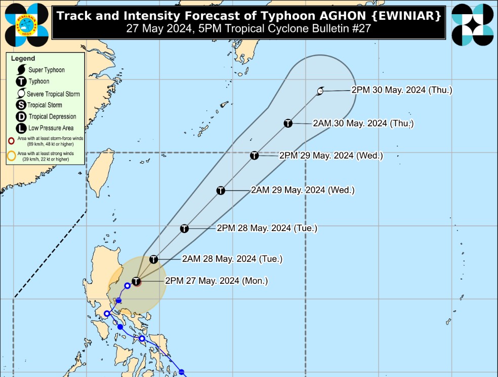
update, PAGASA said the following areas are under TCWS No. 1: As of 4 p.m.
, the center of the eye of Aghon was estimated at 155 km east southeast of Casiguran, Aurora packing maximum sustained winds of 140 km/h near the center, gustiness of up to 170 km/h, and central pressure of 965 hPa, PAGASA said. The first tropical storm to hit the country in 2024, Aghon is expected to move generally northeastward over the Philippine Sea and exit the Philippine Area of Responsibility (PAR) on Wednesday afternoon or evening as a typhoon. Aghon may also continue to intensify over the next two days as it moves northeastward over the Philippine Sea.
“A weakening trend may begin on mid or late Wednesday as the typhoon begins interacting with the mid-latitude environment and undergo post-tropical transition,” the state weather bureau said. The cyclone has prompted several local government units to suspend classes for the day. It also caused flooding in the Calabarzon Region on Sunday, obstructing motorists and stranding commuters in several provinces.
As of Monday morning, the National Disaster Risk Reduction and Management Council (NDRRMC) said seven persons were injured due to Aghon's onslaught. President Ferdinand "Bongbong" Marcos Jr. on Monday said the government has distributed more than P1.
2 million worth of humanitarian assist.