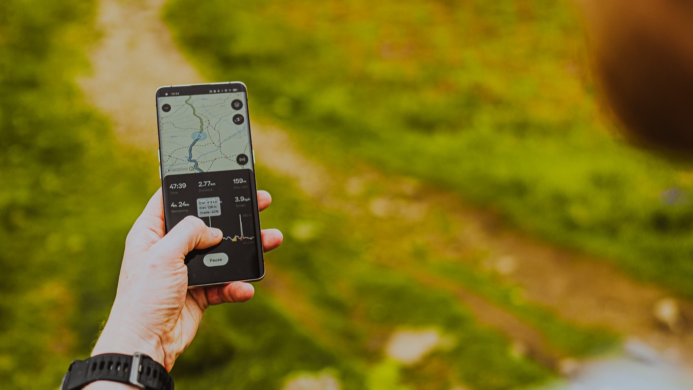
Standing in a hotel lobby with a group of journalists, I’m dressed for the trail in my with a on hand in preparation for the unpredictable weather here in the Lake District. We perform all the typical checks before a hike – , , – then we all get on our phones. We’re here learning all about the and, despite the San Francisco-based company entering its 14th year, it’s all a bit new to me.
Over the years, I’ve become accustomed to it popping up at the top of my search results when I’m looking up a route, and I’ve used it to find out the length of a hike or try to locate a . But as for using it to navigate? I’m afraid I’ve been putting it off. My resistance no doubt has a trace of thinking that paper maps are better, but mostly it’s come down to me not wanting to be on my phone more than I have to when I’m hiking.

But here I am, for the greater good, giving it a good college try. “We want people to get outside and feel confident when they get outside,” explains AllTrails Head of PR Juliana Ead, who’s flown here from California and shows me how to search for the route we have planned today – a 6.4-mile loop taking in Loughrigg Fell, a , Grasmere Lake and Rydal Cave – then download it.
Now, she explains, I can put my phone on flight mode for the duration of the hike and avoid pesky pings and a without losing access to my map. I’m already warming up to the idea. On our ride to the trailhead, I explore the route.
The opening page shows the trail on.